
Spatial Accessibility Measures
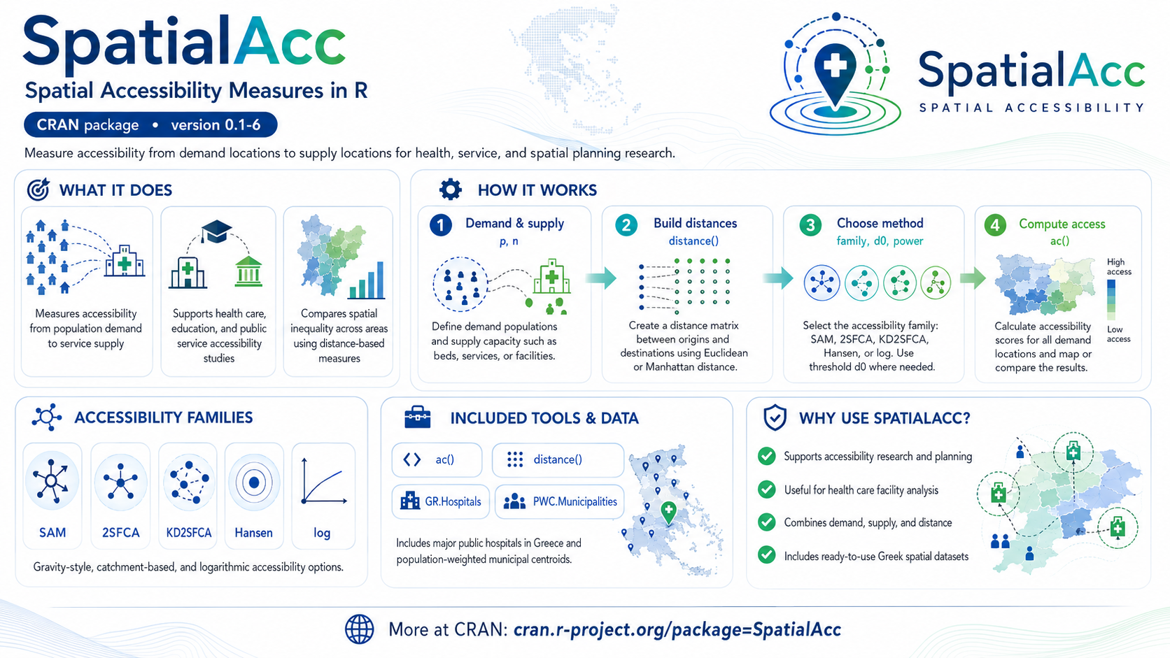
SpatialAcc provides a set of spatial accessibility measures from one set of locations (demand, such as where people live) to another set of locations (supply, such as services). It was designed, among other uses, to support research on spatial accessibility to health care facilities, and it ships with the locations and selected characteristics of the major public hospitals in Greece. Accessibility here describes how easily a population can reach a service given travel cost (typically distance or time), the capacity of the supply, and the competing demand for it — questions that matter for fair access to health care, education, and other public services.
The package implements several established accessibility indicators, including gravity-based and two-step floating catchment area (2SFCA) type measures, so results can be compared across methods rather than relying on a single definition of “access”.
Available in CRAN @ https://CRAN.R-project.org/package=SpatialAcc
Install the latest version from R with:
install.packages("SpatialAcc")Current release: version 0.1-6 (28 April 2026). Requires R ≥ 4.0.
Main functions and data
- ac: Spatial accessibility measures
- distance: Distance matrix computation
- GR.Hospitals: Locations and characteristics of major public hospitals in Greece (dataset)
- PWC.Municipalities: Population-weighted centroids of the municipalities in Greece (dataset)
Changelog
Version: 0.1-6 (28 April 2026)
Code: Maintenance release to comply with current CRAN policies; updated package dependencies (R ≥ 4.0). Updated maintainer contact details and package URL.
Version: 0.1-5 (2 April 2024)
Code: Maintenance release with updates to comply with CRAN policies and package dependencies.
Version: 0.1-4 (6 April 2020)
Code: Bug fixes, update dependencies with other packages and data directory to comply with CRAN policies
Version: 0.1-3 (26 July 2019)
Code: Bug fixes, updates to comply with CRAN policies
Version: 0.1-2 (6 August 2017)
Code: Bug fixes.
Documentation: Corrections.
Contact: New website with contact form and new email.
Version: 0.1-1 (22 May 2017)
ac: Spatial Accessibility measures
distance: Distance Matrix Computation
Datasets
GR.Hospitals: Greek Hospitals
PWC.Municipalities: Population weighted centroids of the Municipalities in Greece
References
Kalogirou, S., and Foley, R. (2006). Health, place and Hanly: Modelling accessibility to hospitals in Ireland. Irish Geography, 39(1), 52-68.
Kalogirou, S. (2017). Spatial inequality in the accessibility to hospitals in Greece, Int. Arch. Photogramm. Remote Sens. Spatial Inf. Sci., XLII-4/W2, 91-94, https://doi.org/10.5194/isprs-archives-XLII-4-W2-91-2017.